This page was last updated on


This page contains links to maps of Bill Seurer's role playing games worlds. I use ProFantasy's Campaign Cartographer 2 to create my maps. To view an image (most are 800x600 pixels) of the map click on the map's thumbnail icon. To download the map click on the Campaign Cartographer 2 (CC2) icon  next to the thumbnail. You can download a map viewer from the ProFantasy website that will let you view and print the actual map.
Nordruth is the main continent on my "main" game world that I started creating back in about 1980 when I was in college. I have used the basic maps for several different campaigns. The two campaigns still relatively active are the "Manacracy campaign" and the "Tropas campaign" as my players call them.
The following group of maps are large areas (approximately 500x800 miles) and are used when my players are going from place place. There's not enough detail on them for much other use. They cover about 1/4 of the continent.
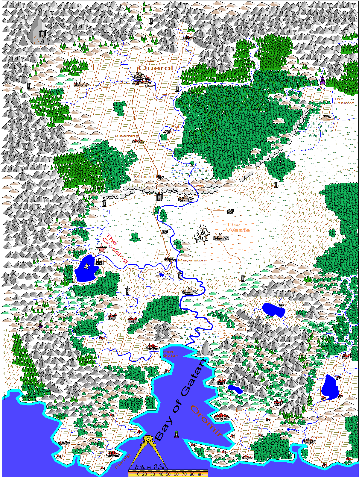
This map was created for the Manacracy campaign from my original hand-drawn maps.
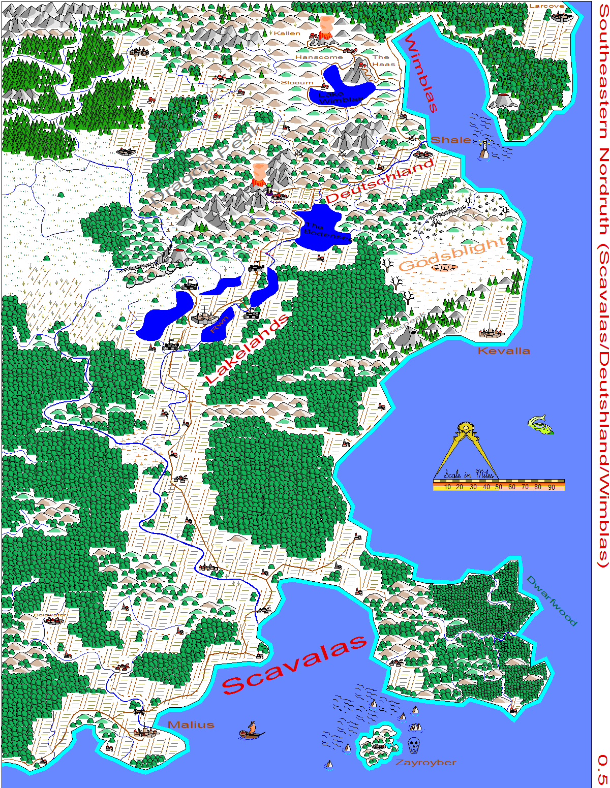
This map is just to the east of the previous two and is shared by both campaigns set in my Nordruth world.
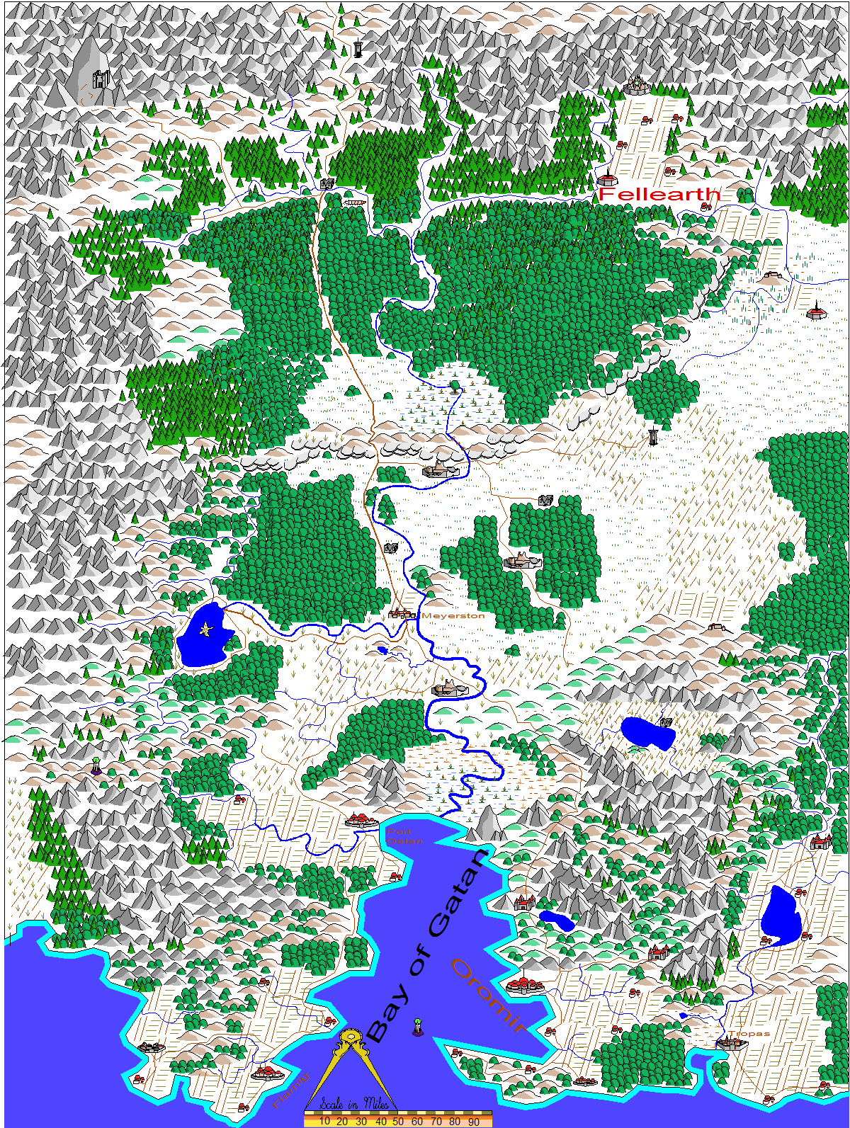
This map was created from the Manacracy version but with the wilderness "restored" for my Tropas campaign.
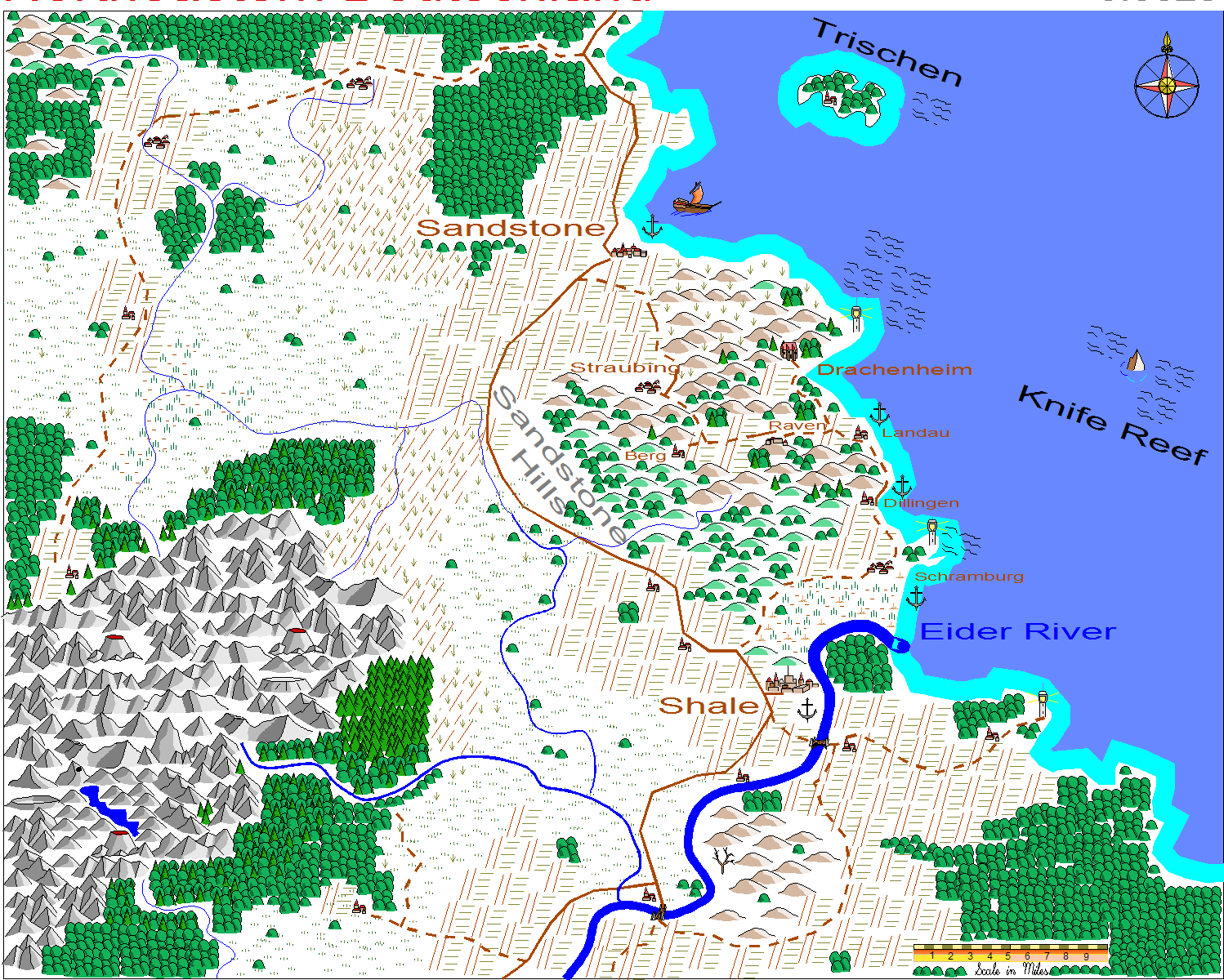
The following few maps are smaller areas covering parts of the earlier maps in more detail. They are at various scales.
This is the area where my second campaign set in the Manacracy world took place.
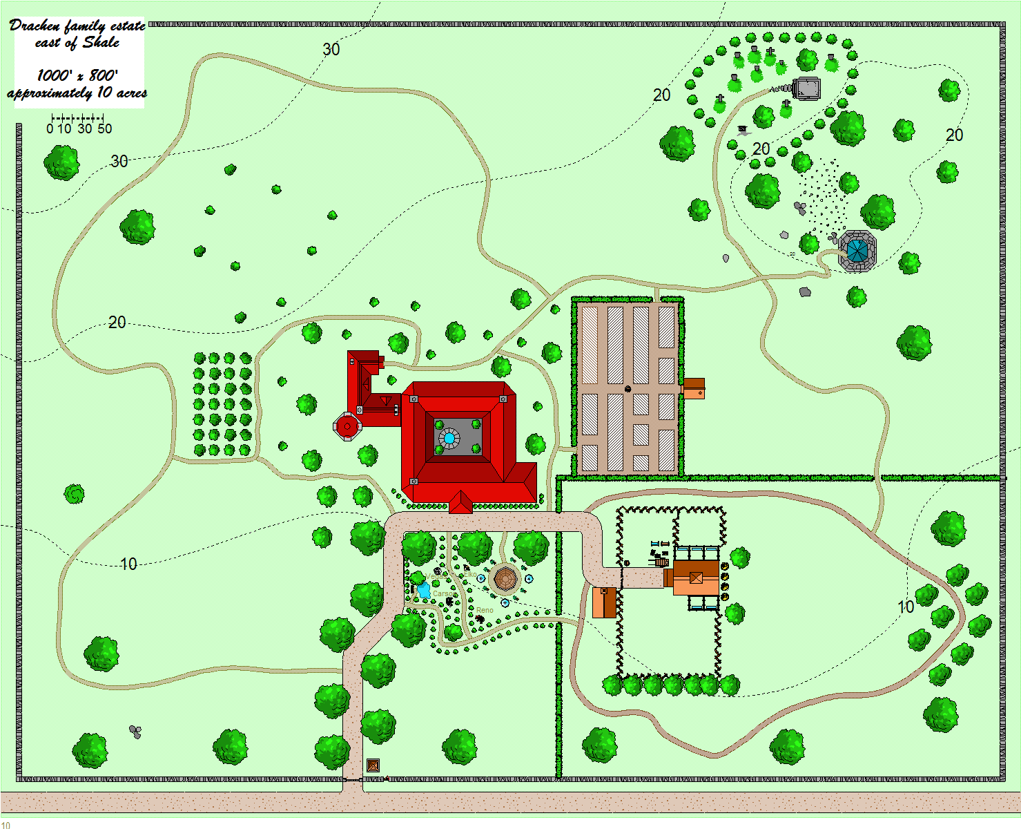
The player's family lived on this estate. This was the first real map I drew with City Designer.
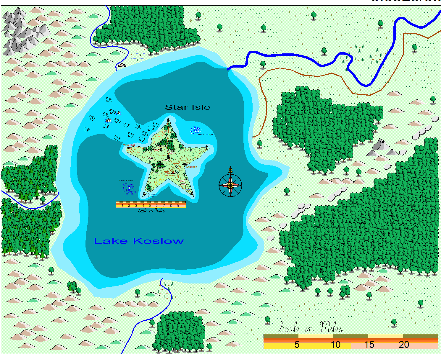
I've run several campaigns set on or near Star Isle. The island is a damaged artifact from an ancient empire.
I made the map as an experiment with using two scales on one map, either zoom in on just the island or view the whole map. I print the two different views and put them back-to-back in a clear document protector.
For some gaming conventions I use a "more generic" world than the worlds I use for my players. I call it "The Twelve Kingdoms".
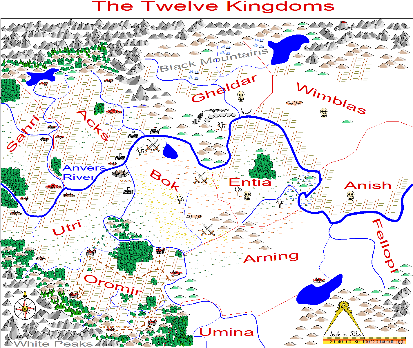
This is the area of the world where the Twelve Kingdoms are located.
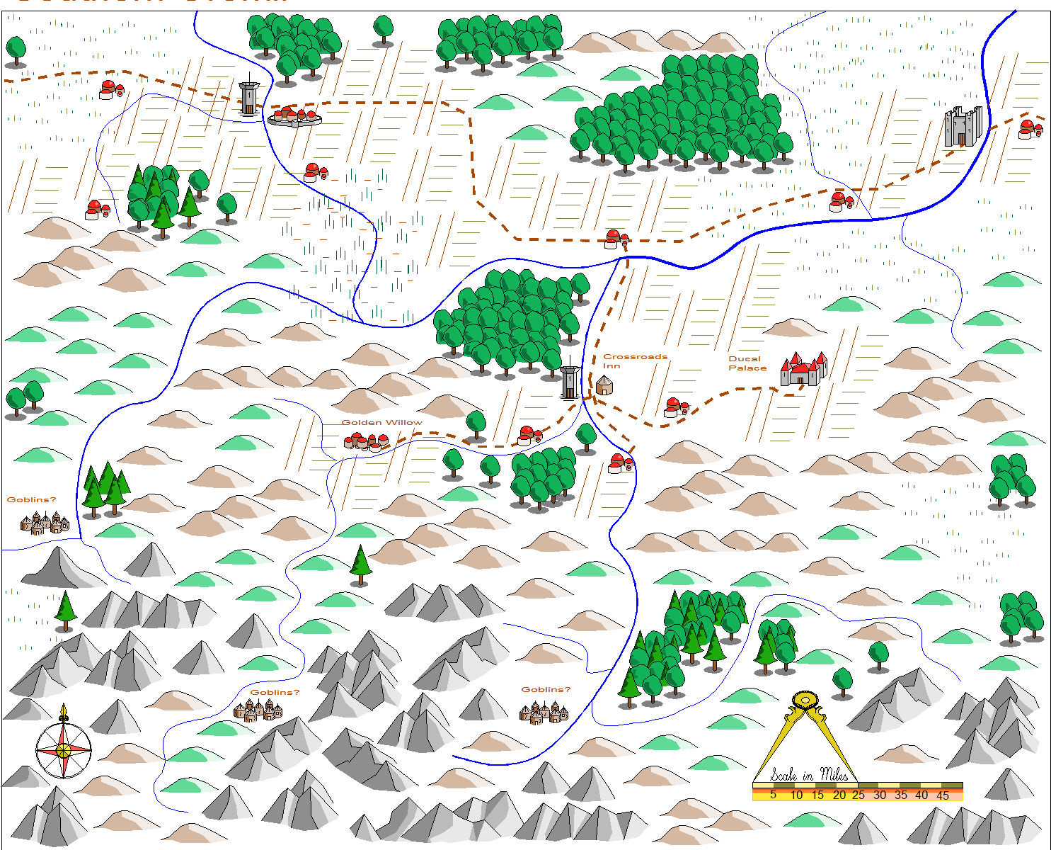
The southern part of the Kingdom of Oromir.
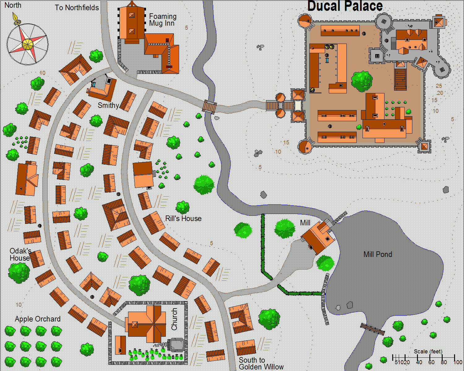
The palace of the duke as well as the nearby village. This is the description I use in-game:
"The palace is an expansion of an older castle. Although fortified its walls are neither very high nor very thick. Its location on a rocky hillside does provide some defensive benefit."
"The nearby village is not very large, only 200 inhabitants, but is the site of the Foaming Mug Inn, famous throughout the 12 Kingdoms for its superb dark ale. The only other locations of interest are the church (an excellent example of 9th century architecture) and the new mill with its innovative overhead water wheel system."
I have some maps that I use for my D&D campaign but most aren't ready for "publishing" yet.
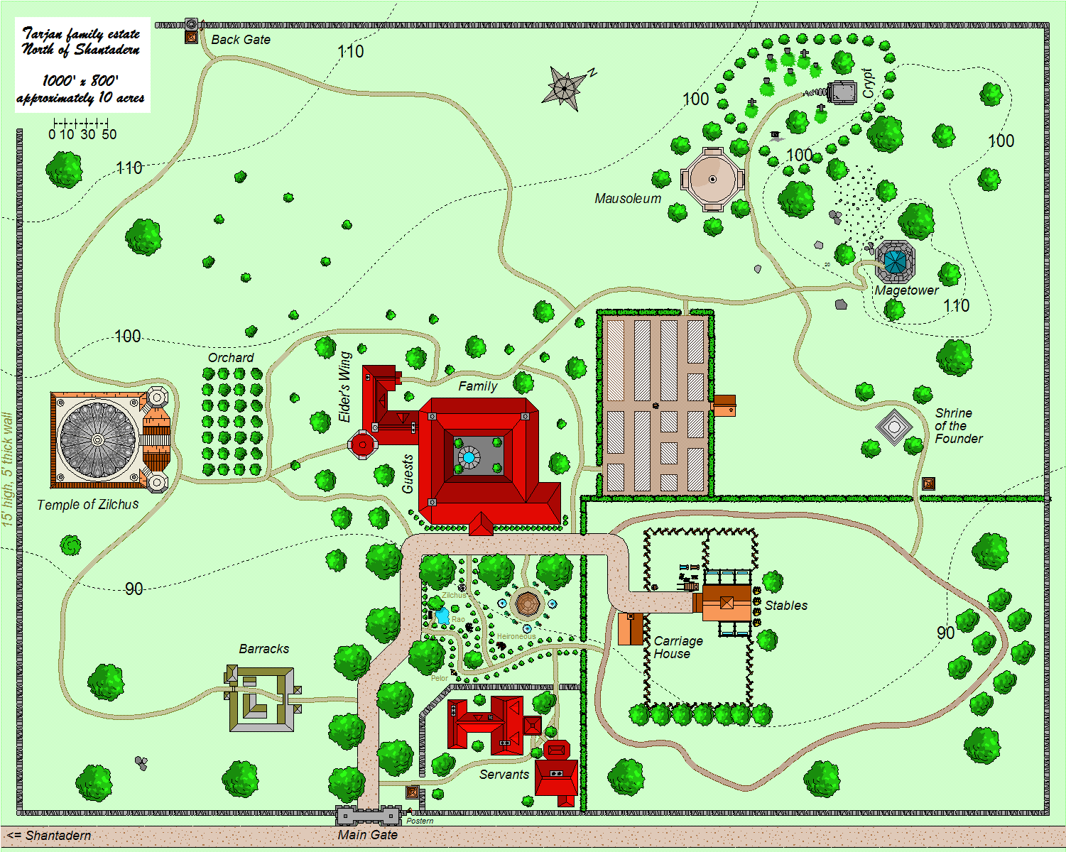
I used the "Drachen Estate" map above as the starting point for this map. This is the estate of a very wealthy and influential family in my D&D campaign set in the Kingdom of Nylond in Greyhawk.
 |
|
 |
|
 |
|
 |
|
